What could be more natural after enchaining 14, 14ers than enchaining one more! Got it in you?! The route to Holy Cross from the Fish Hatchery is in no way a standard way hikers or backpackers opt to summit Mount of the Holy Cross. It’s also a longer distance than any of the other 14er enchantments in this guide. But it is a truly special route that’ll allow you to travel through many, many miles of the gorgeous Holy Cross Wilderness. Route finding and some scrambling skills are very much suggested, as this segment also features some of the hardest, loosest scrambling of the entire guide, as well as some devious route-finding.
Transportation at the end will most likely need to be figured out ahead of time, as the Half Moon Trailhead is much farther from civilization than any other trailhead of this guide and catching a lift is not guaranteed.
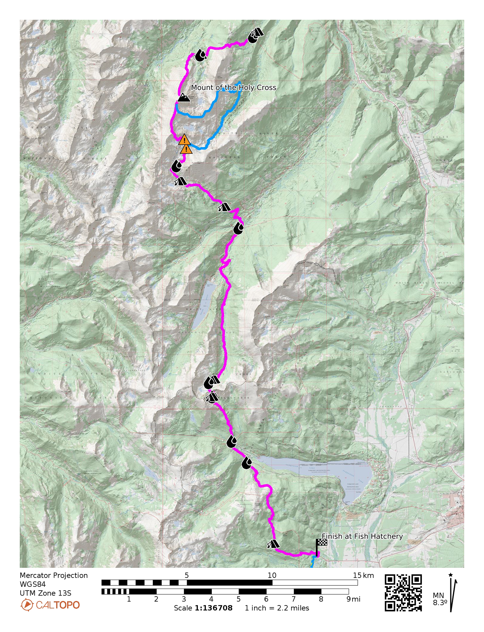
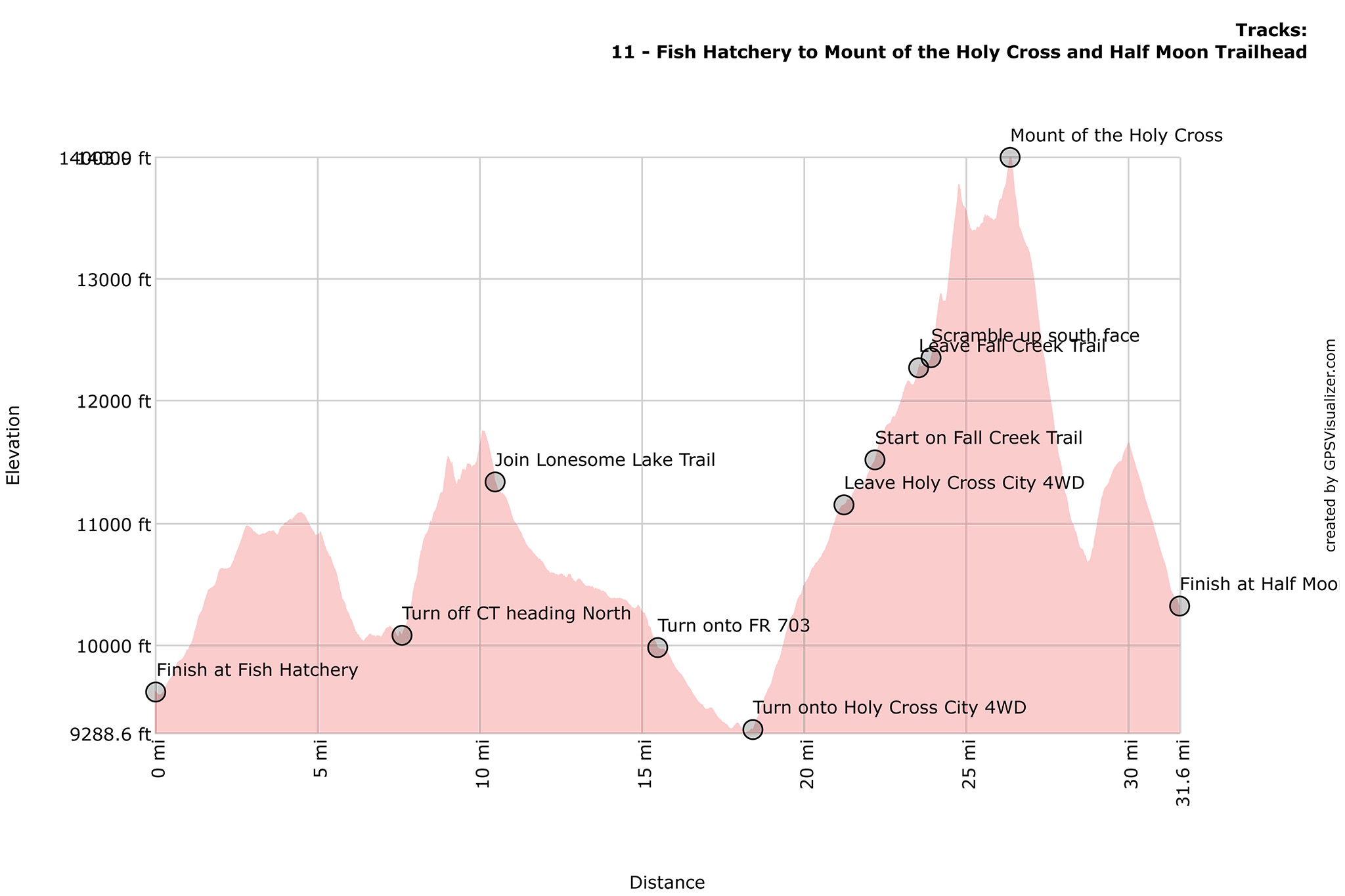
Nolan’s 14 Line Stats
- 31.63 miles
- +10053′
- -9358′
Nolan’s 14 Line
From the entrance of the Leadville Fish Hatchery, exit onto the paved SH 300, and turn left heading north for a few hundred feet. A dirt parking lot and trailhead will curiously appear.
Turn left onto the Kearny Park Trail @ 39.22729, -106.39038 and head west up. This trail will start out very mellow, but will soon turn into utter trash as it ascends back into the woods.
Turn right and head north on the CT/CDT @ 39.23079, -106.42104. Thankfully, the trail conditions have gotten better and most of the first climb on the CT segment is done.
Continue on Seg. 9 of the CT until it crosses the Timberline Trail @ 39.28477, -106.44885. Your time on the CT has come to an end.
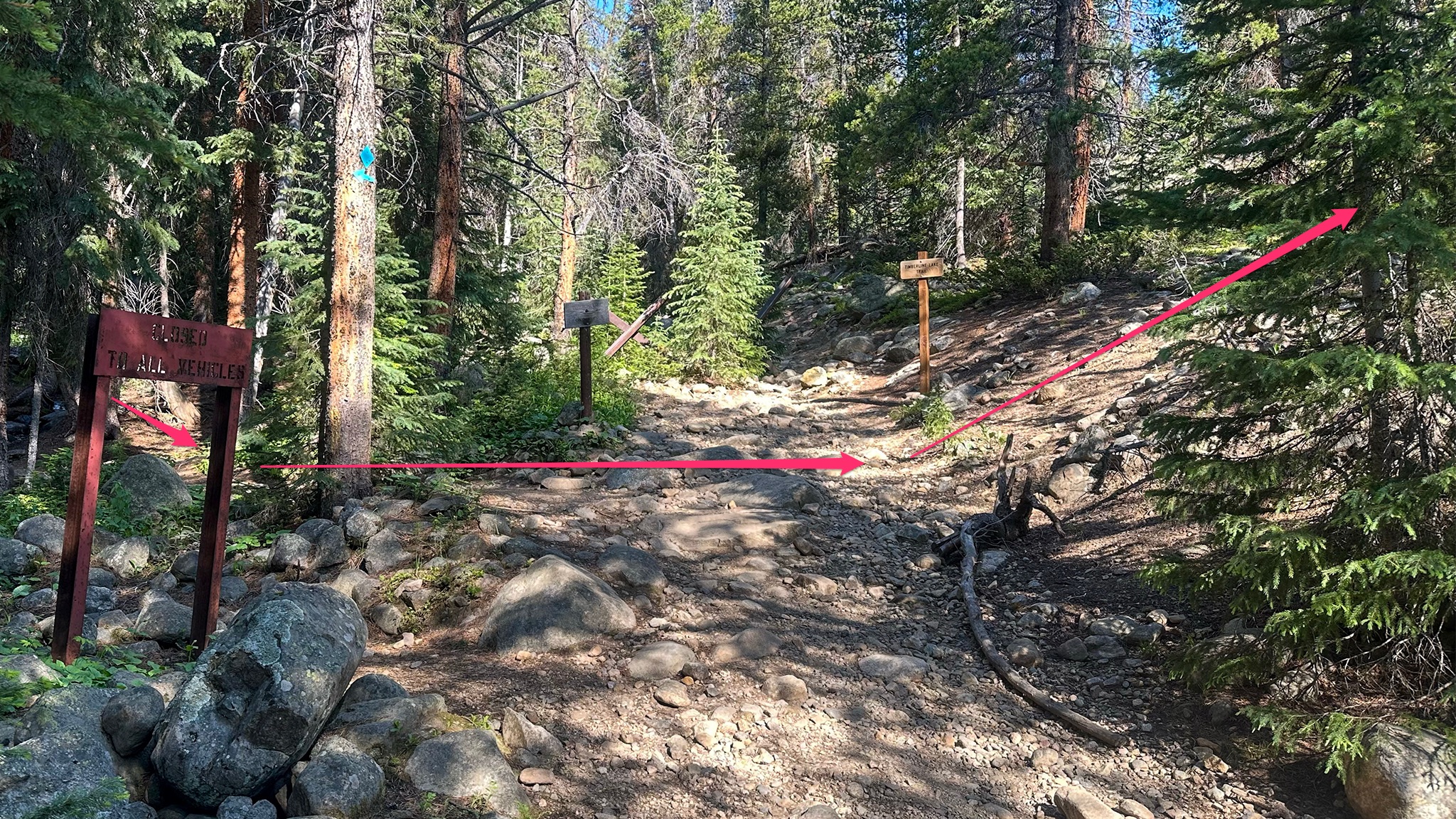
Cross over the Timberline Trail, heading cross country North. Carefully cross Lake Fork Creek — it can run high! — and establish yourself onto a gentle ridgeline that will come into shape around 39.29281, -106.44987. This ridgeline will wander generally North to Northwest.
Reach a highpoint of the ridge at 39.30282, -106.45693. From here, you’ll be side-hilling this ridgeline into a hanging basin heading north. Drop down slightly, finding elk trails to make the going a little easier. You’ll soon find yourself into a clearing as the slope to the north will be talus covered.
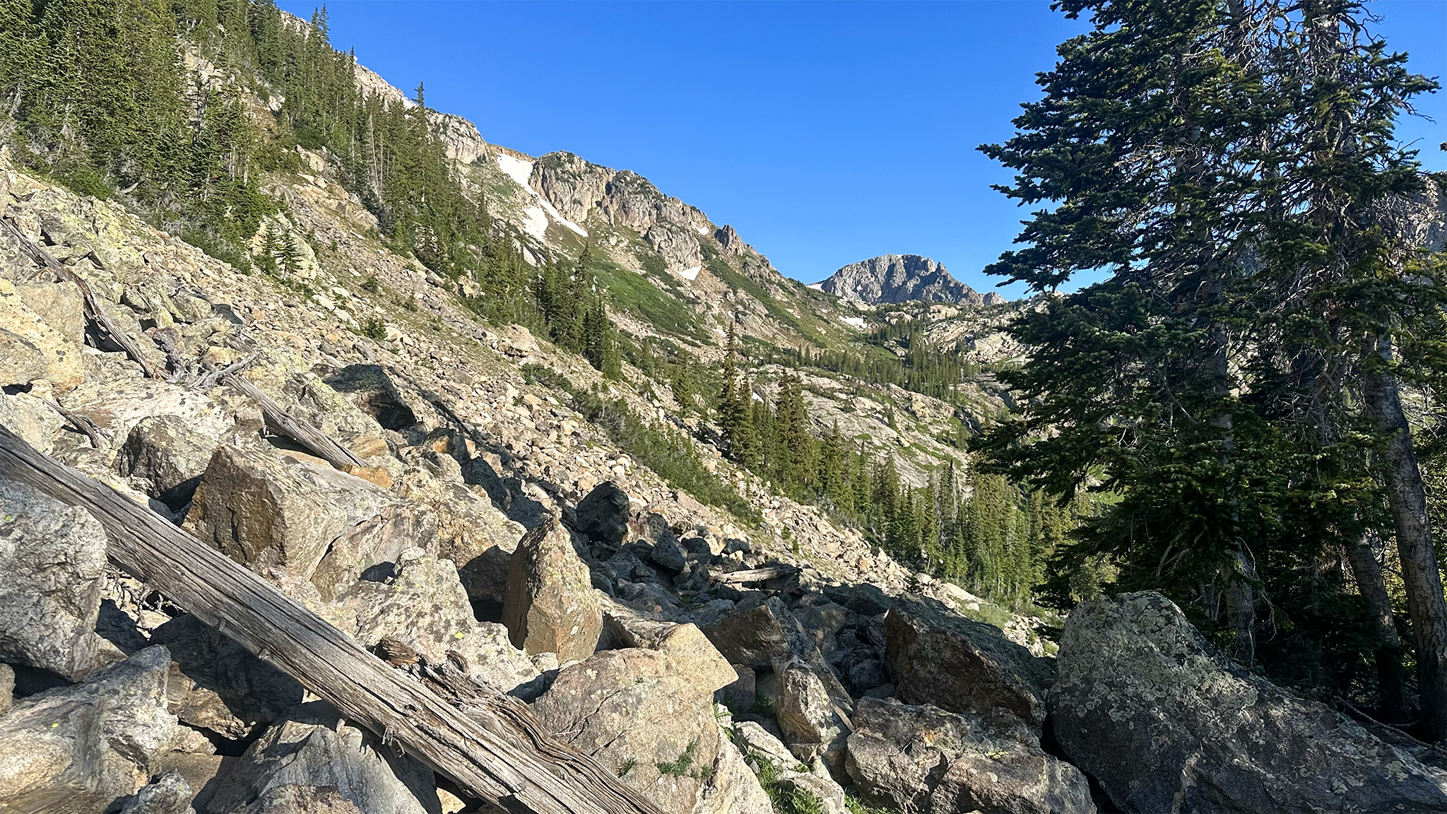
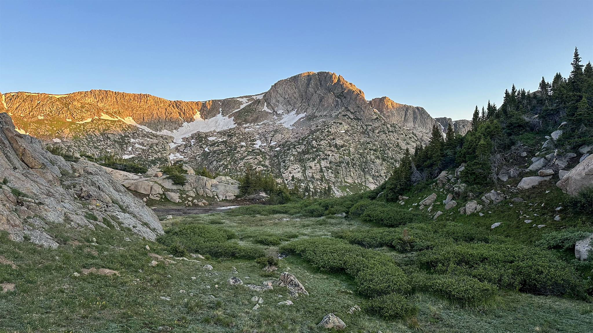
Side hill across the talus, trending slightly clockwise to the creek @ 39.30856, -106.46224. You’ll most likely pick up a social trail to help. Below you will be a gorgeous green basin, topped by glacier polished cliffs.
At the creek, find a small social trail that will take you across the hanging basin on its east side, trending generally north. The social trail will turn Westward @ 39.31134, -106.46151 and take you up a pass between the hanging basin you’ve been traveling in and into the Lonesome Lake Basin.
Summit the pass, and descend down into the basin, traveling generally north. Believe it or not, this is the only pass in the entire guide that crosses the Continental Divide! You have been on the East side of the Continental Divide since Mt. Shavano Trailhead; now you are on the West side.
Locate the Lonesome Lake Trail, and take it northeast turning north until its trailhead with FR 703 @ 39.37415, -106.45628. Water and camping is available throughout this trail. This is a rough, wilderness trail, so expect some creek crossings and downed trees.
Turn right on FR 703 and head north on FR 703 until the Holy Cross City Trailhead @ 39.40309, -106.44347.
Hike up the Holy Cross City 4WD track west. This track is in some places loose. You’ll most likely run into many 4WD enthusiasts. Make sure they know you’re in the area, as their vehicles could be on unstable ground and you may be in their slide path. This 4WD track is far more legitimate than any other 4WD track in the rest of this guide.
At approx. 39.42082, -106.47437 leave the 4WD track, and find a social trail just to the north of the track. The 4WD track will be literally running into a creek. Cross this creek yourself at a reasonable spot — the large and tall creek rocks are slick!
Continuing following a social trail west to Hunky Dory Lake @ 39.42122, -106.48271. No David Bowie sightings have been made. Yet.
Continue on the now Fall Creek Trail into an absolutely gorgeous high basin in a generally northern direction. The time on the road, the 4WD should all now feel worth it.
Leave the trail a little before Fall Creek Pass at approx. 39.43899, -106.48028 heading north, passing the alpine lake in front of you on its eastern perimeter.
Before you is a formidable slope that you will have to crest to gain the ridgeline. If you’re not feeling this climb, take the Slowlans alt.
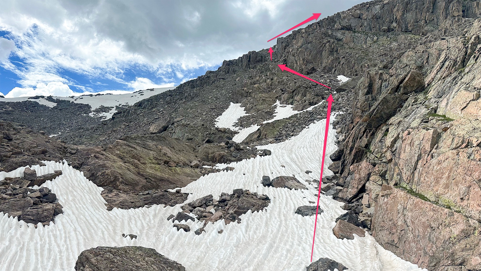
At approx. 39.44555, -106.48222, head westward, hugging the slope to the north. There will be many ways climb this slope and top the ridgeline, but generally to the west are glacier-polished cliffs that you want to avoid by traveling higher.
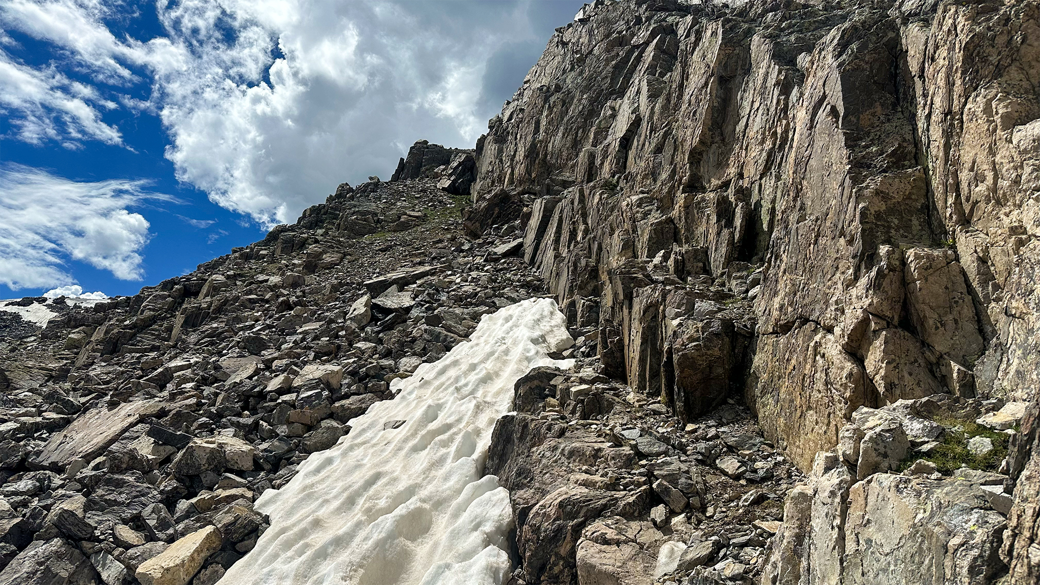
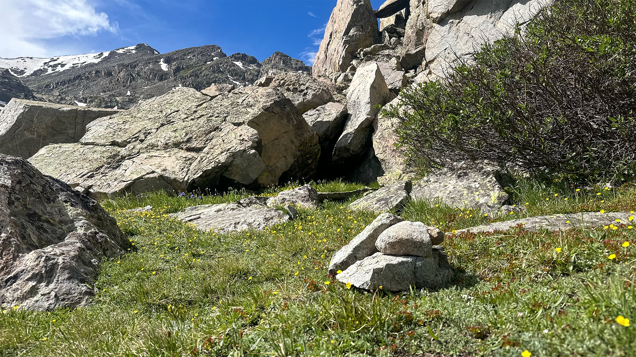
Find a talus-strewn ledge above these cliffs that will give you a sneak up onto the ridge at approx. 39.44430, -106.48639. Below you will be fairly exposed cliffs down to the basin below, and above you is yet another cliff system. Hug the cliff system that’s above you, as you climb steeply up this talus-strewn ledge. Although loose, the scrambling should not feel harder than Class 3. You do not need to climb the cliffs above, this guide attempts to avoid them.
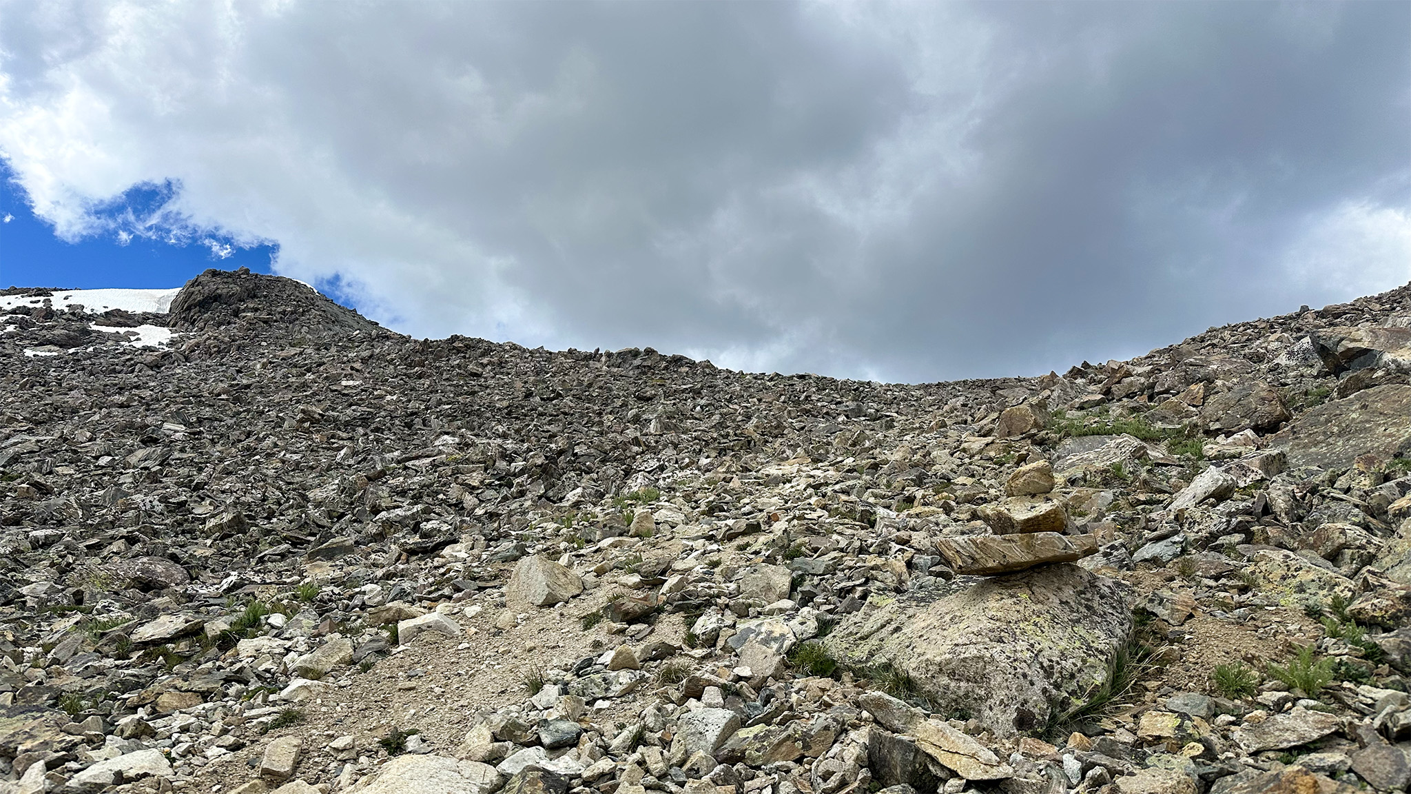
The chunkier talus will give way to scree, and the cliffs above will relax at approx. 39.44588, -106.48819. A well-worn path will be found heading north up the slope — take it. Top the ridgeline to the east of PT 13786.
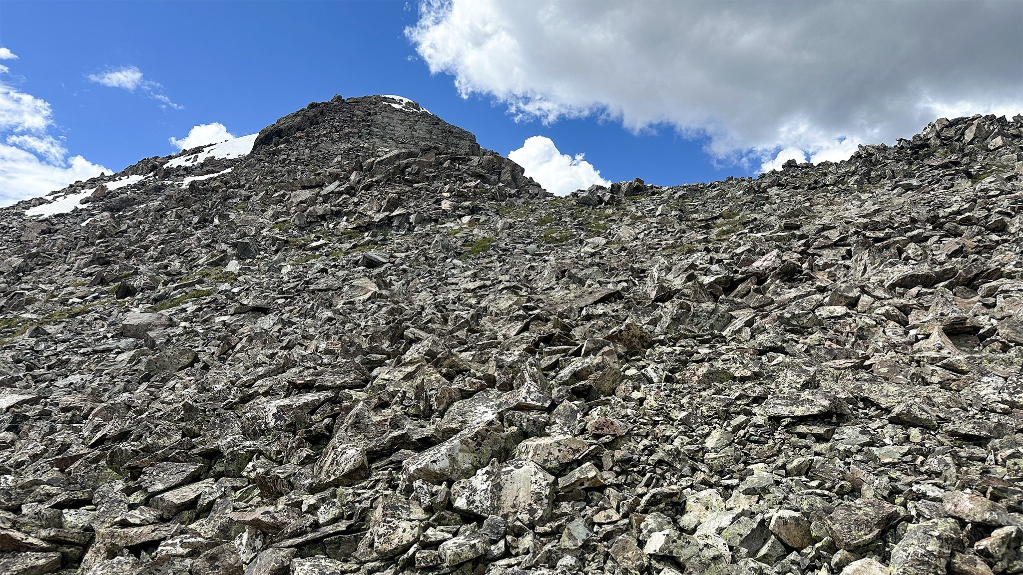
This peak looks formidable, but the cliff on its east side can be easily hiked just to the west. Summit PT 13786 and continue north on the ridgeline towards Holy Cross Ridge. If you would like to summit Holy Cross Ridge, have at it. Or, side hill the summit of Holy Cross Ridge start around 39.45615, -106.48938, aiming for, 39.46323, -106.48711.
Mount of the Holy Cross looms to the Northeast. Scramble the chunky talus and social trails to its summit.
Celebrate! But, know that your work is not over — you still need to get to the Half Moon trailhead! Head generally north on the Mount of the Holy Cross standard route to the Half Moon Trailhead. It’s not all downhill, as the Half Moon pass needs to be traveled across.
End your Holy Slowlans at the Half Moon Trailhead. If your odyssey started at the Shavano Trailhead, congratulations on a feat that only a few have dreamed of doing and far fewer still have ever completed at any speed!
Slowlans Alternative
If the slope up onto Holy Cross Ridge leaves you with a terrible feeling in the pit of your stomach, there is a more reasonable — albeit longer alternative.
In the Seven Sisters Lake Basin, stay on the Fall Creek Trail over Fall Creek Pass, until the trail junction with the trail up the Notch Mountain Shelter @ 39.47104, -106.44264.
Take the Notch Mountain Shelter Trail west to the Notch Mountain Shelter @ 39.46955, -106.45951. Head cross country south on the ridgeline, which will bend west, then northwest. You’ll summit Holy Cross Ridge (a Centennial). Continue hiking off the ridge traveling Northwest and join the Holy Nolan’s route at approx. 39.46287, -106.48704.
Summit Mount of the Holy Cross! Congratulations! Make your way down to the Half Moon Trailhead via the standard route of Mount of the Holy Cross.
Water
Water is not difficult to source on this route:
- Water is usually flowing around the Leadville Fish Hatchery
- Busk Creek near Turquoise Lake @ 39.27435, -106.43912
- Lake Fork Creek @ 39.28560, -106.44944
- The headwaters of Mill Creek @ 39.30904, -106.46252
- Homestake Creek @ 39.31660, -106.46494 and all along the Lonesome Lake Basin
- Fancy Creek at the Holy Cross City 4WD Trailhead @ 39.39796, -106.44477
- The French Creek Headwaters/Seven Sisters Basin @ 39.43074, -106.48698 – this will be the last good water source until after summiting Mount of the Holy Cross
- East Cross Creek @ 39.48891, -106.47079
- Notch Mountain Creek @ 39.49853, -106.43494
Camping
Camping is also plentiful along this route:
- On the CT at Kearny Park (many other camping spots along the CT) @ 39.23161, -106.42086
- Mill Creek Headwaters @ 39.30890, -106.46266
- In the Lonesome Lake Basin @ 39.31817, -106.46145 – camping is plentiful along the Homestake Trail, but this trail has many areas that are wet and buggy.
- On the Holy Cross City 4WD track @ 39.40902, -106.45411
- Near Honky Dory Lake @ 39.42263, -106.48414
- East Cross Creek @ 39.48886, -106.47055 (numbered dispersed sites, popular)
- Half Moon Campground @ 39.50103, -106.43179 USFS, first come, first served
Bailing/Resupply
The easiest resupply point do would be to resupply at the finish of Slowlans/Start of Holy Slowlans at the Leadville Fish Hatchery, or a little further at Turquoise Lake. A hitch from either should be doable. A good resupply would be at the Half Moon Trailhead at the very end. If you’re “planning” to hitch, it would behoove you to have enough rations to perhaps wait it out, as a ride is not guaranteed.
After getting off the CT, bailing will be difficult and your best bet may to go back the way you came, until you get into the Lonesome Lake Basin.
Once in the Lonesome Lake Basin, you can hike out onto the Homestake Reservoir Road and try to hitch from there (difficult).
At Fall Creek Pass, continue on the trail northeast to the Half Moon Trailhead.