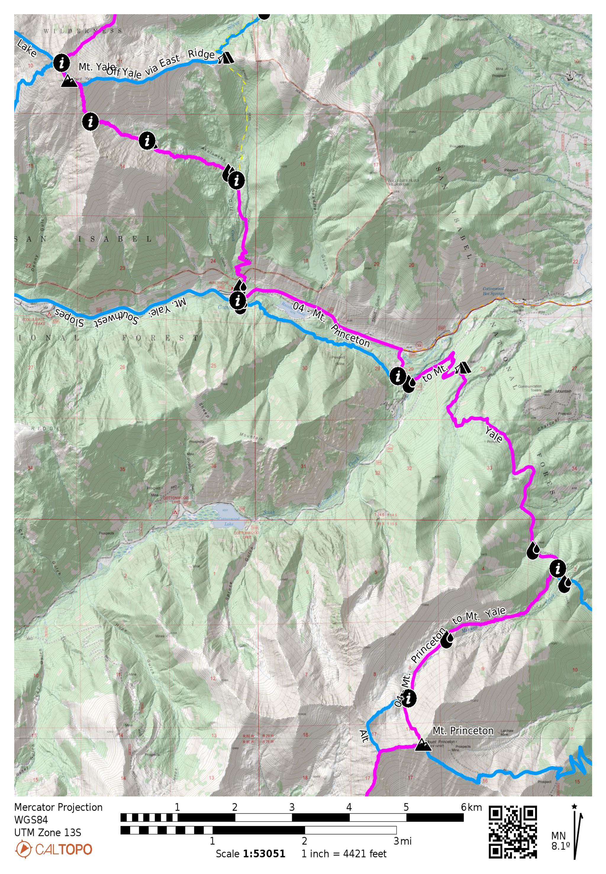
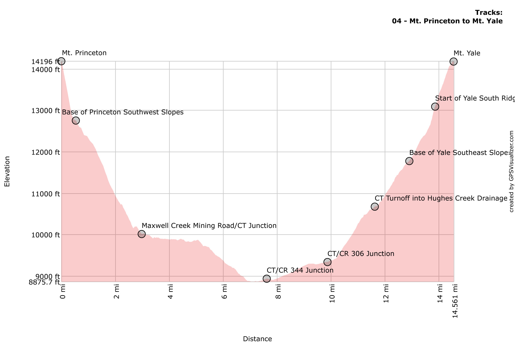
The summit of Mt. Princeton gives one a commanding view of the next mountain summit on Mt. Yale! Drop into the Maxwell Creek drainage and join up with the Colorado Trail for a well-earned rest of your adrenal system. We’ll be taking Yale’s Southeast Slopes route to the summit of Yale for more excellent views!
Nolan’s 14 Line Stats
- 14.57 miles
- +5532′
- -5536′
Nolan’s 14 Line
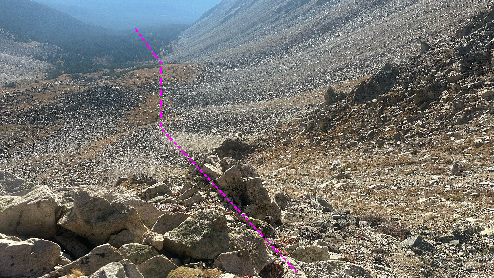
0.0 Summit of Mt. Princeton. Drop off Princeton’s Northwest Slopes fairly directly to the Maxwell Creek Drainage. The going is fairly direct, but it beats out all other direct options, so pick your way carefully among the steep talus, finding a somewhat stable path.
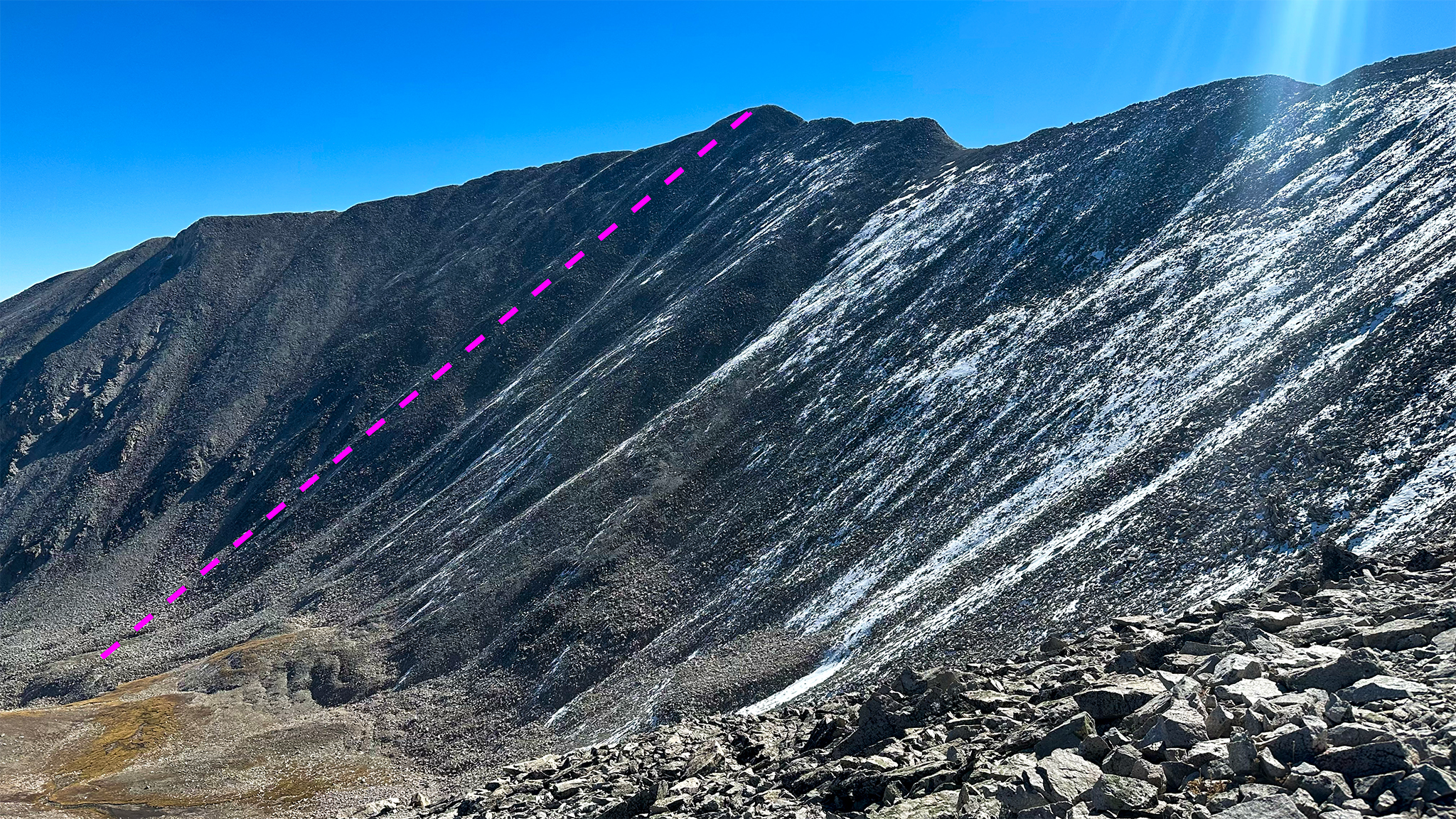
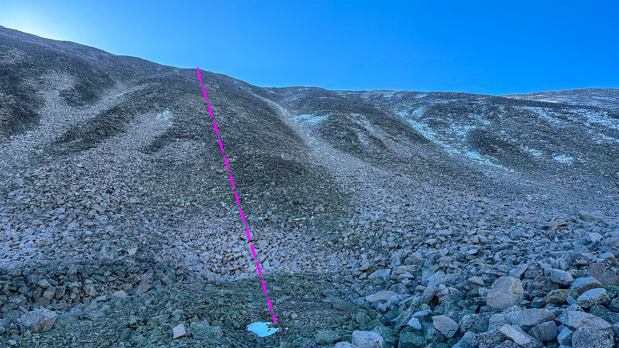
0.56 Maxwell Creek Drainage. Water is available high up the drainage as soon as you get off the steep slope proper.
Descend north then northeast down the drainage and find a key old mining road near treeline.
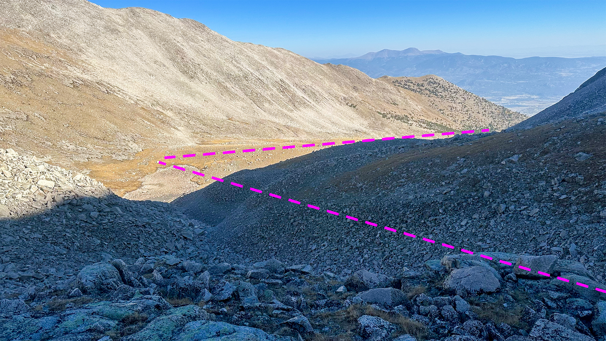
2.03 You should have found the mining road by now. Follow this old mining road until it reaches the Colorado Trail (38.76653,-106.23103). This mining road ends near Maxwell Creek, a fairly dependable seasonal water source (38.77221,-106.21385).
2.9 Colorado Trail. Follow the Colorado Trail North until CR 344/Cottonwood Lake Road.
7.44 Colorado Trail/CR 344 Junction, low point of the segment. The most expedite path is to turn right onto CR 344 heading north, then (7.74) turn left onto the busy, paved CR 306 heading west, but for a few minutes more, you can cross over CR 344 and continue on the Colorado Trail heading west. It will eventually cross CR 306 and bring you to the Avalanche TH.
9.84 Avalanche TH. Once at the Avalanche TH, continue on the Colorado Trail ascending its tight switchbacks.
11.39 At approx. 38.83001, -106.27993, turn off the Colorado Trail heading northwest cross country. Cross a small seasonal stream, then cross Hughes Creek, which should be a dependable flow.
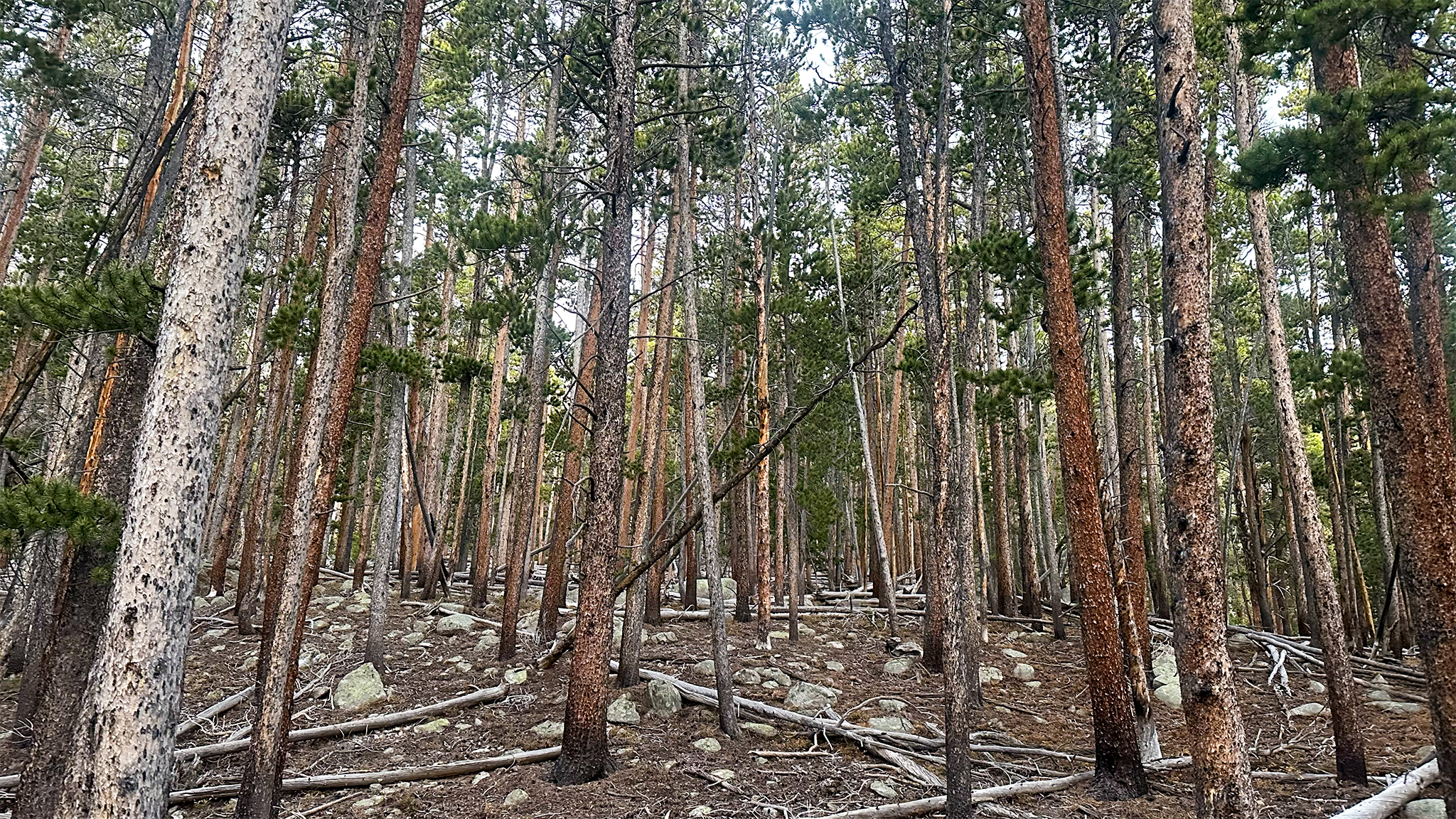
Travel cross country through the sparsely wooded forest of Yale’s Southeast Slopes, just to the south of the Hughes Creek drainage. Travel should be easy going and good high camping can be found at treeline. Talus fields will appear to the south, but try to skirt them to the north as you make your way higher.
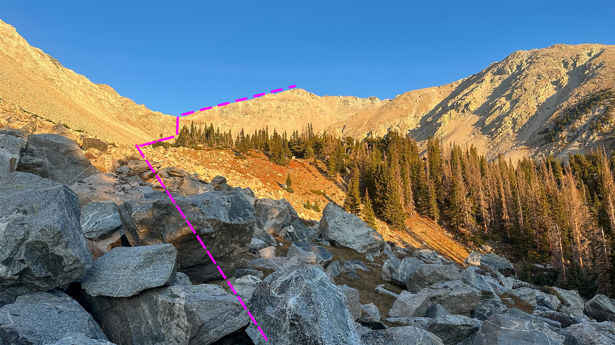
13.25 Gain the South Ridge of Yale and talus hop your way to the summit.
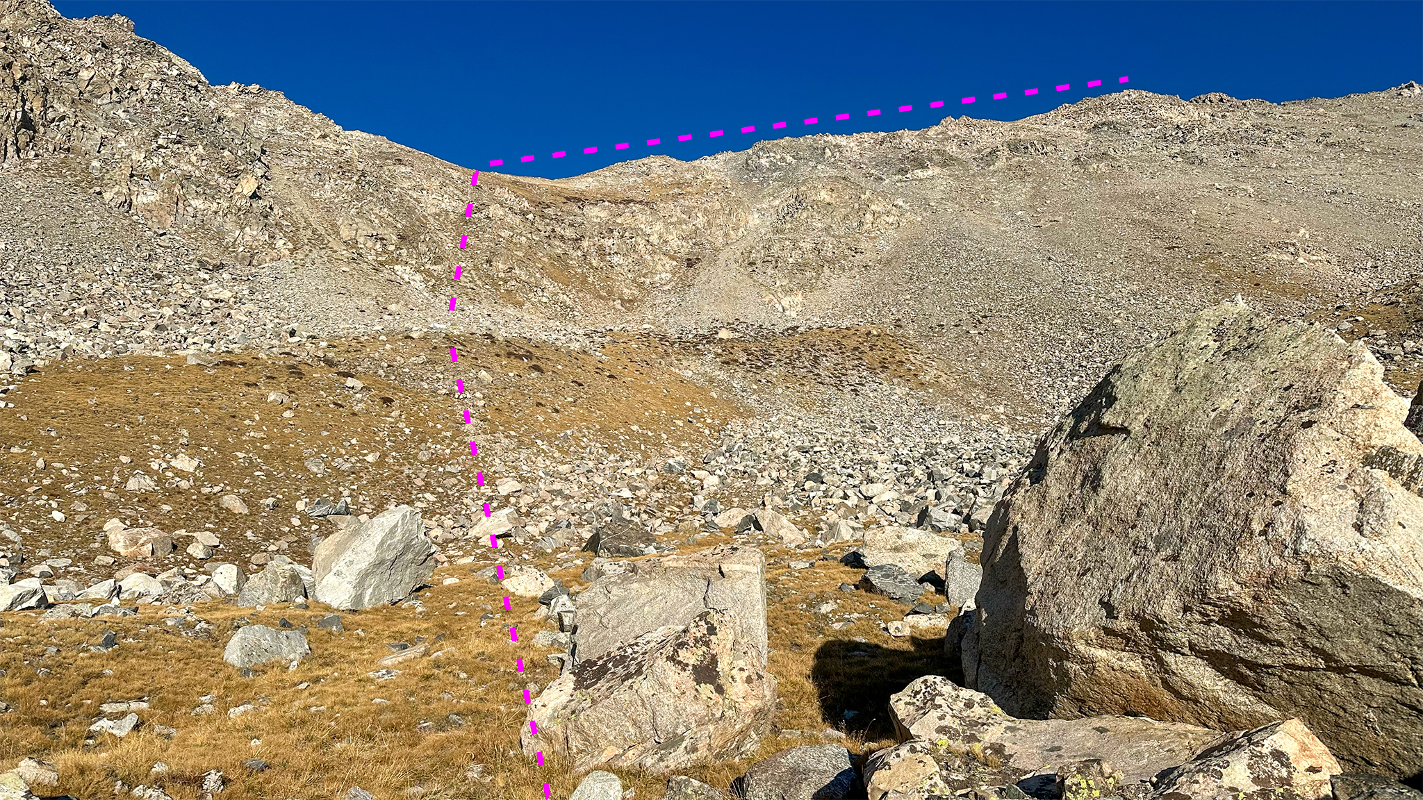
13.75 Summit of Mt. Yale
Slowlans Alternative
Descending Mt. Princeton: Standard Route
If more ridgeline walking/aspen tree bushwhacking is not to your liking, take the standard, east slopes route off Mt. Princeton (14ers route description). This route isn’t the most pleasant of all the 14er routes, as the east slopes are somewhat loose (more annoying than dangerous). The route will turn from a trail through the talus, into a dirt road near treeline, before hooking back up to the Colorado Trail. Take the Colorado Trail north and enter back onto the main Nolan’s 14 line at Maxwell Creek (38.77221,-106.21385). This is a fairly long detour.
Descending Mt. Princeton: Northwest Face Sneak-around
If you would like to skip the steep talus rubble of Princeton’s Northwest Face, but still want to descend down Maxwell Creek, there is a way:
Double back down the ridge you came up on the Nolan’s line to approx. 38.74827, -106.25114 and take a new to you ridgeline you find there northwest. At approx 38.75220, -106.25379 head northeast on yet another ridgeline, which will take you down to the Maxwell Creek Drainage. You may even discover a social trail on this mellow ridgeline to help you out. At approx. 38.75583, -106.24555 rejoin the main Nolan’s 14 line.
Ascending Mt. Yale: Standard Route
When the Colorado Trail crosses CR 306 (road), take CR 306 west to the Denny Creek TH. Take the standard Southwest Slopes route up Mt. Yale (14ers.com route description). This is an easier route than the East Ridge route.
Ascending Mt. Yale: East Ridge
Starting at the Avalanche TH, ascent the Colorado Trail to the pass at approx. 38.84755, -106.28203. From there, turn west and ascend the summit of Mt. Yale via the Mt. Yale East Ridge route.
Water
Water is first available in the Maxwell Creek Drainage at approx. 38.75559, -106.24572, as well as sporadically down the drainage.
Once below treeline, the creek is in a deep gulch and is more difficult to access until you reach the Colorado Trail. Head the wrong direction for a few minutes to rediscover it at (38.77221,-106.21385).
There may well be several seasonally flowing creeks along the Colorado Trail towards CR 306, including at: 38.77702, -106.22023,
Water is available at South Cottonwood Creek on the Colorado Trail, before it goes across CR 306 (38.80087,-106.24520). There should be other sources nearby as well.
Water should be available at the very beginning of the East Ridge route of Yale, just a few hundred feet after the parking lot for Avalanche Gulch (38.81453,-106.27936).
Water again may be available on the Colorado Trail at a seasonal creek that feeds into the main Hughes Creek as it parallels close to the Colorado Trail itself (38.83108, -106.28155).
Water may not be available again until after you descend Mt. Yale, and reach North Cottonwood Creek, on your way to Mt. Columbia (38.87060,-106.29330).
Camping
Dispersed camping can be found all along the Colorado Trail, with the easier-to-find spots more near to where the Colorado Trail parallels CR 306 (38.80317,-106.23438).
A dry, dispersed campsite can also be found at the start of the East Ridge route up Mt. Yale, where then route branches off from the Colorado Trail (38.83008, -106.27992).
A high camp can be found below Yale’s Southwest Slopes at approx. 38.83530, -106.29757
Bailing/Resupply
The closest town in the line between Mt. Princeton and Mt. Yale is Buena Vista. Hitching from CR 306 east will bring you right into town – CR 306 itself will turn into main street. Buena Vista has many of the luxuries of a trail town including grocery stores, restaurants, spirits, a gear shop, post office, whiskey distillery and motels to sleep off your hangover.
From Mount Princeton
From the summit of Mount Princeton, the most expedient route off would be to take the standard east slopes route. Return to the main route exactly as if you were taking the Slowlans alternative, which also uses the standard east slopes route for descent.
From Mt. Yale
No matter the route, simply reversing your route down to CR 306 would be the wisest choice if bailing on your climb up Mt. Yale. The Nolan’s 14 line down Mt. Yale is highly exposed above treeline, and descending into the valley floor below consists of descending down a particularly steep avalanche chute.
Skipping Mt. Yale
From the Colorado Trail/CR 306, continue north of the Colorado Trail to the Silver Creek TH (38.86559,-106.24125). Hike west on CR 365 for about a mile to the North Cottonwood Creek TH (38.87065,-106.26509). Pick up the main Nolan’s 14 line near the Horn Fork Basin and Kroenke Lake trail junction (38.87114,-106.29268).