The Continental Divide Trail/Colorado Trail essentially parallels the 14ers in the Sawatch which makes it useful for creating easier loops that use segments of both the Slowlans and the CDT/CT. This is a way to hike a shorter Slowlans segment, without having to set up a shuttle. Although not highlighted in our guide, the loop segments on the CDT/CT have plentiful water sources and camping. Here are some ideas:
Shavano/Tabeguache/Antero/Princeton
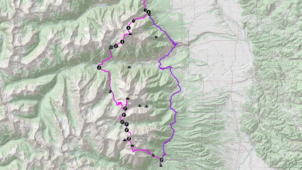
Shavano to Princeton represent the first third of the route, mileage-wise:
- Slowlans Segments: 25.44 miles, +12,891′, -12,614′
- Colorado Trail Segments: 17 miles, +4,213′, -4,486′
- Loop Total: 42.44 miles, +17,104′, -17,100′
The southern terminus of the Slowlans route is the Mt. Shavano trailhead, which takes you right to the Colorado Trail (note: this is a different trailhead than the Angel of Shavano Trailhead). From this trailhead, follow the Slowlans route from Shavano to Princeton, and descend Princeton to the Colorado Trail as this guide describes in the following segments:
Once back on the Colorado Trail after you’ve descended Mount Princeton, instead of traveling north, travel south back to the Shavano Trailhead via the Colorado Trail.
You can shorten this loop up in a few ways: take the Browns Creek or Little Browns Creek Trail to where it joins up with the Colorado Trail after finishing Tabeguache or Antero (a little backtracking is needed for Antero) and take the Colorado trail south to the Shavano Trailhead.
Yale/Oxford/Belford/Missouri/Huron
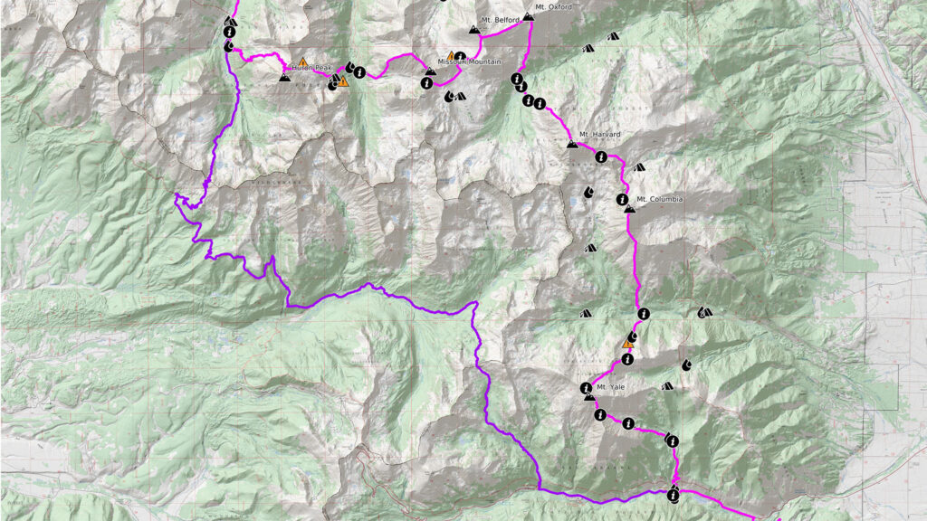
Yale to Huron represent the second third of the route, mileage-wise.
From the Avalanche Trailhead (plentiful parking) follow the route from Yale to Huron and descend Huron to CR 390 2B/Huron Peak TH. Instead of traveling north on FR 390 2B, turn left to travel south on CR 390 2B, getting onto the Lake Ann/CDT/CT Collegiate West trail up and over Lake Ann Pass.
Continue on the CDT/CT until you reach the Texas Creek trail. Turn Left heading east on the Texas Creek Trail. Turn right heading south onto the Brows Pass Trail and summit Browns Pass. Descend from Browns Pass down to the Denny Creek Trailhead. Reach CR 306. Turn left heading east on 306 and walk/hitch the 1.3 miles back to the Avalanche TH.
The looping segment adds 25.72 miles with 5,017′ ascent, -6,222 descent.
La Plata/Elbert/Massive
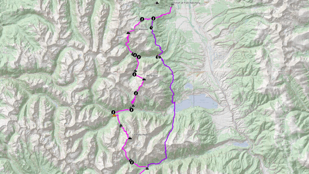
La Plata to Massive represent the last third of the route.
From Winfield at the end of Chaffee County 390, follow the route up La Plata, Elbert and Massive. Descend Massive on the Highline Trail to the Colorado Trail/CDT. Instead of crossing the CT/CDT, turn right and take the CT/CDT south.
Near Twin Lakes, take the trail to Twin Lakes, rather than continuing east on the CT/CDT. Hike to the south side of Twin Lakes, either by taking the Collegiate West/CDT, or by crossing more directly. Crossing directly may mean fording Lake Creek, which could be difficult to do in the early season or late in the day.
Continue on the CT/CDT over Hope Pass and down the other side. Continue following it to Winfield and back to your starting point.
The looping segment adds 22 miles with 5,484′ ascent, -6,249 descent.
Of course, you can also start this loop from the Fish Hatchery as well, traveling south on the CT, before summiting your first 14er. You can extend this loop as well, by summiting any of the other 14ers found off of Chaffee County 390. When descending Hope Pass, continue south to the Sheep Gulch Trailhead, then cross the road to start up the Missouri Gulch Trailhead to access the main route on Oxford, Belford, Missouri.